Sunday, 20 November 2016

Heading South

Hello again everyone! I've had few months' hiatus from posting, but now that I'm back in Southern Ontario for the winter and have some free time I'll try to catch up on my past three months' adventures. And with the the first dose of winter hitting us today here in Ontario, why not warm up again with tales from hot and sunny Arizona?

At the end of this summer's season on the Nevada Bird Count I had the opportunity to make a trip I'd wanted to do since my first season in the project: a monsoon visit down to SE Arizona. In late July into August thunderstorms sweep through the state daily, adding moisture to the parched environment and allowing the plants, birds, herps, and other wildlife to flourish. During this 'second spring' many of the birds are in full song (unlike most places at this time of year), and many species of hummingbirds are either making their way from the north or coming up from Mexico. In addition to the birds, I was almost more excited for the herping in this region, as the storms allow frogs, toads, lizards, and snakes to be more active than in the hotter, drier part of the summer. Rattlesnakes in particular were one of my main goals, as Arizona hosts an amazing 11 species of these impressive venomous critters.

This year I was lucky in that my co-workers Ned Bohman and Kayla Henry had some free time before going back to work, and Kelly Colegrove from GBBO's Crescent Dunes project decided she and her dog Maebe could take some time off to join us as well. So plans were set, and after being set free on our last Friday of work we made plans to head south for Arizona!

Friday July 22, 2016

After our season end lunch in Reno was had and loose ends were tied up, we headed back south at a later-than-hoped-for 3:30pm to Yerington to load up Ned's trusty steed, Sally Suby, with all of our gear. Ned's friend Nai joined us for the first leg of the journey, since her car had broken down in Tonopah the week before and she needed a lift. It made for a tight fit, but we packed up the car tetris-style and in about an hour we had packed and continued on our way.
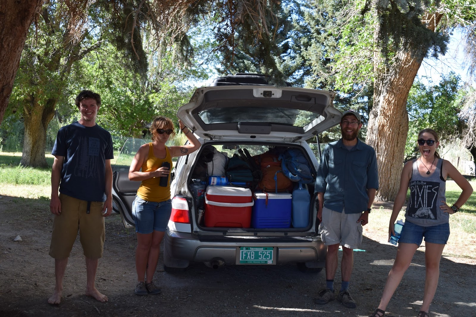
The Crew: Ned, Kelly, me, and Kayla, with a well-packed Sally Suby

When we added Nai and Maebe the dog it was a tight fit! 

The ride down was a long one, but it passed easily with good tunes and good company.  Around dusk we pulled into Tonopah to drop off Nai with her rig, then the four of us continued on towards the Mojave. Our original plan was to stop around Las Vegas for the night, but as Vegas came up we decided to push for Arizona and make ground while we had the stamina. By 1am we made it to Boulder City and, having missed all the fast-food turnofffs in Vegas, had dinner of an egg salad sandwich and a large loaf of garlic bread in the lamp-light parking lot of a 24h grocery store. It was starting to feel like a real road trip!

Parking lot dinner at 1am
Photo credit: Kelly Colegrove

We soon crossed the Colorado River which marked the border of Arizona, and continued on for another hour before crashing in a picnic area in the Hualapai Mountains for a brief sleep.

Saturday July 23, 2016

At 6am we were up again, with very few birds singing and none of the hoped-for Hepatic Tanagers, Painted Redstarts, or Olive Warblers that mark the NW edge of their range in these sky islands. We packed up camp quick before the wardens woke up and made their rounds, and soon were on our way towards Flagstaff for breakfast. As we climbed up into the mountains and neared the town we entered back into the Ponderosa Pine forest. After some breakfast burritos at a local coffee shop we headed to a nearby park to bird a bit and stretch our legs. Lucky for us, immediately after stepping out of the car we heard the squeaky voice of a Lewis's Woodpecker. This was Ned's nemesis bird, and we were all happy to join him in celebration and watch the gorgeous woodpecker in the pine above us.

Lewis's Woodpecker

Ned, Kayla and I FUTSed around the Flagstaff Urban Trail System for a while and enjoyed the montane birds while Kelly took Maebe to the dog park to burn off some steam. There I saw my first of the Red-backed subspecies of the Dark-eyed Junco in addition to some Pygmy Nuthatches, Mountain Bluebirds, and a nice male Red Crossbill showing well as it fed on the ground. Another treat was my lifer Abert's Squirrel, with long fuzzy tufts on its ears leading to it's other common name, Tassel-eared Squirrel. No photos of it unfortunately.

Ponderosa Pines in Flagstaff

In town we bumped into an entertaining crew member from Ned's work on Desert Tortoises in the Mojave last fall, so we chatted with/listened to him for a while before continuing on south through the mountains. We elected to take a slight detour through Oak Creek Canyon, and despite the swarms of tourists that had invaded it on that weekend day it was still absolutely spectacular. The road runs through a lush riparian canyon surrounded by red rock cliffs, and was definitely worth the extra time. It was really refreshing to see dense oak, maple, sycamore, ash and more, such diversity after working most of the summer seeing only cottonwoods and aspen for deciduous trees.


Near the creek we had a singing Huttons Vireo, as well as a Yellow Warbler that we tried to turn into a Red-faced (we swear it sounded funny). Further down the canyon widened out and transitioned to PJ with some Alligator Juniper which we hadn't seen before.


After passing through the tourist trap of Sedona we were back on the open highway and covering good ground. Soon we began to see signs that we were entering the transition zone between the Mojave and the Sonoran Deserts. An ocotillo here and a palo verde there were all cool to see, but the heralds that sent gasps through the car when they first made their appearance were the mighty Saguaro cacti, the lords if the Sonoran. As we headed further towards Phoenix they be went from ones and twos to dominating the surrounding hills, and were impressive indeed.

Despite venturing deeper and deeper into the American Southwest, it was nice to see a bit of Canadian culture in the form if a road sign Gordon Lightfoot would have approved of.


We arrived in Tucson, the gateway to SE Arizona, in the late afternoon, and headed for the Borderlands Brewery for a snack and a drink. While navigating the roads trying to find it we spotted a prickly pear cactus full of fruit. Apparently Ned had tried them down in the Grand Canyon the fall before and they were absolutely delicious, so we stopped to try one out. I had the honour of harvesting one of the pink fruits and attempting to carefully remove all of the tiny, hair-like spines or 'glochids' with my belt knife before consumption. Ten minutes of ginger work resulted in a few fingers full of irritating spines and a single bite of unpleasant fruit before tossing the rest away. A consolation prize was an emerald-coloured scarab that had been shriked on one of the leaves.

Scarab beetle cashed by a shrike on a prickly pear

After our refreshment stop at Borderlands we headed east through Tucson towards the Santa Catalina Mountains where we would spend the night. The plan was to find a burrito place Kelly knew about on the way for supper, but it turned out to be closed for the evening, so we continued to the mountains without. However, we soon forgot our grumbling stomachs as we gawked at the cacti-covered hillsides in the fading light of the sunset and the view of the desert below.


Photo credit: Kelly Colegrove

Sunday, 14 August 2016

Season End Celebration

Nevada Bird Count Tour 7 Part 3

At the end of the last birding tour of the season, it's tradition that the crew head to some incredible place of Jen's choosing to spend a couple days birding, relaxing, and having campfire cookouts. This year the location was Onion Valley Reservoir, nestled in the Pine Forest Range a bit farther north than our Black Rock survey sites. The crew had come here at the end of season 2 years ago and we'd heard good things about this beautiful site (including the fact that one of the NBCers had a Long-tailed Jaeger on the reservoir that year), so we were excited to see it. Would it really be that much different from the Black Rock/High Rock we'd spent weeks at this season?

Once getting to the road it took us over an hour to climb up out of the dry, cheat-infested salt desert of the flats below up into the range. For most of the drive the incoming ridges hid the glory of Onion Valley from us, but eventually we crested the height of land and were given views of massive aspen stands and pockets of mountain mahogany and pine crowning the peaks. No photo of those first views unfortunately, but soon enough we were in camp next to the reservoir itself.

Camp at Onion Valley Reservoir

On these season end events, each of the crew does have to work in that they need to collect some sort of data, but they are 'fun' surveys. Everyone got the choice of surveying a pre-existing transect, create their own transect, or (the best option) survey a 1km x 1km atlas square. The atlassing essentially entails picking a square of cool country out on the map and then birding it the next day, trying to maximize your species list and track down as many baby birds as you can. No time constraints, distance estimation, temperature measurements etc., just straight birding! Always a refreshing way to end the season.

For myself I chose a section over the closest ridge from camp, with some high-ish peaks on my plot in the hopes of getting some Coniferous Forest habitat. Proper coniferous forest, with Limber Pine and the like as opposed to Pinyon-Juniper, is a real rarity on the NBC, and I was hoping it would produce some fun birds. For instance, the last time the crew was here they found some breeding Hammond's Flycatchers, one of the few places in the state that has them.

That morning, July the 11th, we woke up to temperatures below freezing, which surprised me not only for the time of year but also that we were only a bit over 7000ft. It was tough crawling out of bed, and even tougher clambering up the steep slope with thick vegetation before I even got to my square. It was a pretty rough start, and I had thoughts of just turning around since it was only 'fun' data, but I'm glad I didn't. Even before it warmed up, I was rewarded with some breathtaking views of the reservoir and surrounding hills. A Golden Eagle drifted over the peaks in the dawn light.

Onion Valley Reservoir at dawn

Misty Mountains

But eventually the temperature warmed up, my bones thawed out, the birds became a little more active, and my spirits improved. Climbing up high enough I did eventually reach the Limber Pine, where a group of Clark's Nutcrackers with their fuzzy babies provided some entertainment. I got to watch some 'cracking nuts' as well.

Limber Pine and a snow patch clinging on


And the views got even better as I got higher.


Near the top a family of Mountain Bluebirds was fun to watch. Here's the male blending into the sky:

Male Mountain Bluebird

And one of the three hungry babies:

Fledgeling Mountain Bluebird

As they often are on these high elevation sagebrush patches, the wildflowers were lovely to see as well.

Castilleja and other wildflowers in the sage

The square was quite varied in its habitats, which was great for atlassing. The higher elevations were mostly Limber Pine as I'd mentioned, but in places the hilltops were covered with Mountain Mahogany. These patches looked great for Virginia's Warbler, a bird I've encountered once and that remains on my 'heard only' list, but none made there presences known. Ned and Bobby had similar patches on their squares but struck out as well.

Mountain Mahogany patch

As I made my way down from the peak, I had my highlight sighting of the morning and possibly the season. I was coming the hillside when 10m away a large animal burst out from underneath a pine in front of me. In that first split second I thought by the tan colour it was a Mule Deer, but then its shorter profile, smooth bounds, and long, snake-like tail trailing behind it became clear. The Mountain Lion made one, two, three, four, five bounds of increasing length before disappearing into a thick stand of young aspen. I'd seen their tracks numerous times both of the last two seasons, and they can be found almost anywhere in the mountains of the state, but it takes a lucky moment like that to actually come across one of these majestic cats. While the view was brief, and I didn't get to see its face, coming across my lifer cat at 10m was pretty exhilarating and kept my pumped for the next while. It was running away downslope and I'm not typically too worried about predators (particularly during the bright light of day, as it was now 8:00 or something), but I didn't follow it to try to get a better look haha.

Further down-slope I came back into the aspens, with some creeks winding their way through and a few patches of open sage. Along one of those creeks an angry Slate-coloured Fox Sparrow eventually lead my to its silent fledgeling, and a stealthy Orange-crowned Warbler chipped as it carried food to its own. A pair of Warbling Vireos likely also had young around, but they were being very uncooperative as I watched them and I wasn't able to confirm their breeding.


The lichens on the dead pine are always striking.


Lower down yet I discovered a series of seepy meadows surrounded by willows. A local pair of Red-naped Sapsuckers had put wells into many of the willows, and this attracted wildlife like California Sister butterflies.


California Sister on Red-naped Sapsucker wells

Some excited chirping and buzzing lead me to a family of Rufous Hummingbirds, a female with 3 young. This tour had been interesting with finds of this species, because 3 days before Ned had found a family down on MR-SummerCamp, and the day before Bobby and Kaitlin had found a similar group along BlackRockMahogany. What makes these finds so interesting is that this species has never been confirmed breeding in Nevada. Now, Rufouses (Rufi?) do start migrating early, so our birds could very well have been post-breeding migrants, but the fact that many were still hanging around in their family groups was notable. Perhaps the fact that no one on the crew had any sightings of this species on either of our previous tours up here lends more evidence to these birds not being breeders, but it'll definitely be something for future crews to look our for.

Juvenile Rufous Hummingbird
The meadows opened up even more as I followed the drainage down to the edge of my plot, and here I was able to add Yellow Warbler families to my list as well as White-crowned Sparrows and many more Fox Sparrows. This area rounded out my square and a solid circuit of different habitats, summing up to 33 species for the morning with about a third of them confirmed breeding. A great morning out in the Pine Forest Range!

Mountain meadow

When we got to camp everyone shared their finds from the morning. I have to say my Mountain Lion took the cake, but Bobby found a Northern Goshawk nest on his plot which is pretty high up on the list of awesome. At last season's end-of-season get together I found my first (and only) goshawk nest in the Toiyabes, and I was pretty keen on seeing another one. Kayla had never seen a goshawk, and Ned was always down to track down one of these awesome raptors, so the following morning before heading back south we quested to Bobby's atlas square to find these mighty accipiters.

After driving towards Blue Lake we navigated to the UTM Bobby had given us and quickly found the nest. Bobby had said that the young were fledged but still hanging around the nest while he was there, but on our visit the forest was quiet an the birds were no-where to be found. We were hoping the birds might make it easy for us when they discovered us, coming in screaming with talons drawn, but they didn't materialize so we hiked out of the stand into the meadow above with the hopes of a better view.

Northern Goshawk nest

On our way out a massive accipiter did pass us in the dim dawn light which, through the bins, I was barely able to make out the gray mantle and white eyebrow of an adult Gos. Unfortunately after we made it to the meadow and set up to wait for another fly-by the birds did not cooperate. It was a lovely meadow though, and the sun warmed us on the chilly morning.

Shadows of goshawk searchers

After packing up camp we started the long drive back south. Coming down from the range we had a few Chukar, one of which teed up on a rock for us.


At the turn-off for the main road we made a stop at Gridley Lake, a mostly dry salty playa, to try for Snowy Plovers. A potential lifer for Ned, Kayla and I had only seen the species a few times before so, so we hiked down to the shore to check it out. Sure enough, the plovers were there, chasing the clouds of gnats across the saline puddles of the lakebed. In a distance patch of water there was a much larger group of peeps, Western and Least from what I could tell, accented by a few tall Avocets and Willets.

Gridley Lake

On the way out Ned caught this big Desert Horned Lizard.

Ned with his Desert Horned Lizard

And so ended out last birding tour of the NBC. One heck of a season with an amazing crew, I'll definitely miss Nevada's deserts and mountains, and the birds, critters, and people I met there. Next year I don't see myself returning for a third season in a row, but maybe some year down the line I'll find myself coming back to this great project.

After the season's end Ned, Kayla, Kelly (from GBBO's Crescent Dunes Project) and I headed down to Southeast Arizona, where in my 5 days with them and 7 days on my own tallied 49 life birds, some 20 new herps, and saw loads of awesome things. However, we'll see when I get around to recounting those adventures, since when this posts I'll be up at James Bay for to survey shorebirds for 4 weeks, after which I'll be at banding at Thunder Cape Bird Observatory for another 5 weeks. Too much content and no time to write it! Anyhow, thanks for reading along with my wanderings in Nevada, and hopefully when I get the time I'll be able to get some photos and stories up about the next legs of my travels.

Tuesday, 9 August 2016

When Roads Fail

Nevada Bird Count Tour 7 Part 2

Following our sage-grouse-filled expedition into the Virginia Range, Ned and I made the long haul up to Black Rock/High Rock on the 6th of July to finish our birding season. Ned had drove us out of the mountains, so I drove most of the rest of the way, with 37 of the Tragically Hip's greatest hits to help me along. We met up with Kayla in camp and, to our surprise, met someone else sharing our camp! Other humans are not something we often see in the wilderness of Nevada, but this hunter was down from Oregon to scout the area for Mule Deer hunting in the fall.  Apparently he'd seen some 22 different bucks in the hills over the weekend, so he should luck out come deer season.

The following morning I was gifted with doing an easy transect along Mahogany Creek. A two-track followed the creek for most of the way through the riparian aspen stand, making for an easy hike.

MR-BlackRockMahogany

This late in the season the birds are often quieter because they are coming to the end of their breeding cycles, but consequently one gets confirmed breeders out the wazoo. Numerous families of House Wrens were chattering in the understory along with young Green-tailed Towhees, White-crowned Sparrows, and Gray-headed Juncos. Baby woodpeckers always make a real ruckus, and some hungry young Red-naped Sapsuckers lead me to their nest. After a couple veg points I headed up-slope back to the truck and a Golden Eagle glided over, a bird I never get tired of seeing. While almost back at the truck, I spotted a medium-sized bird sitting up on one of the burned snags on the edge of the valley. It looked to be about kestrel-sized but seemed quite dark, so I got the bins on it to check it out. The bird that looked back at me was a watercolour of iridescent green, pink, gray, and red, the one and only Lewis's Woodpecker! A pretty localized and sporadically-distributed bird in Nevada, I'd only seem them once before down south. After a few moments it took off and showed off it's very corvid-like flight.

On the drive back across the sagebrush hills I came across a large group of wild horses around a nearby watering hole. We see them fairly often around the state (Nevada has more than any other state), but this group of 60+ animals was my best look at such a large group.

Wild Horses

I met up with the Ned, Kayla, Bobby, and Kaitlin who had all done surveys to the west, and after relaxing a while headed up towards Leonard Creek Ranch where Kayla and I would finally get to survey on MR-Leonard and MR-Chicken. These couple transects follow some very steep creeks up into the Pine Forest Range, and were supposed to be both strenuous and gorgeous. After my easy transect that morning I was ready for something more challenging, especially since this tour I wouldn't have my regular bout with UpperColeman.

The next morning I assaulted MR-Leonard. The transect was actually only bad for the first 4 points, after which  it leveled out into a series of meadows. To get to those meadows, however, one had to climb up 2000ft in the space of about a kilometer. As I made my way upward, a phrase came to mind that my partner Alan from last season had picked up in Utah "It's not a real hike if you're not using your hands." While I don't agree with the validity of that saying in all circumstances, this was one of those kind of hikes, and both hands and feet were used to haul myself up by grasping shrubs and crawling over granite boulders. Fox and Song Sparrows, Yellow and MacGillivray's Warblers sang to me as I climbed, and the occasional hummingbird zipped (most too fast to ID). Eventually I made it to the top, and got view of the way I'd come:

View from the top of Leonard

There were some cool-looking granite outcrops on the way up as well:


Upon reaching the top the transect, I was rewarded with some beautiful open meadows and larger aspen stands (as well as level ground). Up here a few forest birds like Western Tanager, Cassin's Finch, and Western Wood-Pewee were sprinkled in with the shrub- and sage-dwellers.


Unfortunately there was one aspect that really took away from the beautiful landscape of the transect. This late in the season the cattle had made their way up to graze these meadows, so unlike the times when Dave and Kaitlin surveyed it, the entire place was chewed up and stank of manure. I was already pretty sick of cattle at this point and their aroma at this site didn't help improve matters. Really too bad, as this would have been one of my favorite transects otherwise.

At the very end of the transect was a small mountain lake, a prize for reaching the final point. To augment the prize, my first Prairie Falcon in a few weeks flew over as well.

Lake at the top of Leonard Creek

The point by the lake marked my last point count of the season, and my last point count on the Nevada Bird Count for the foreseeable future. It didn't really hit me at the time, but it's been a good run with the project, and I'll we'll see if I come back to the NBC some season in the future.

After completing our final transects the crew got together to make a plan to knock out all of the remaining rapid veg surveys in the Black Rock the following day. Ned, Bobby and Kaitlin offered to attack the steep slopes of Leonard and Chicken to clean up the many points that remained there, while Kalya, Dave, Sue and I headed into town for gas then further west to clean up the transects towards Mahogany Creek.

The morning of our veg day I awoke to the barking of a Long-eared Owl flying above my tent. Really my bird-of-the-season, as I happened to trip over them all over this summer. Another bird was hanging around in the shrubs near the creek next to camp. As the sun rose it lit up the clouds in impressive colours, and Sue enlightened us with a new twist on an old adage "Red sky in morning, birders get the f@#$ our of Black Rock." We thought her words were funny and not prophetic, but we should have heeded her warning.

Red sky in morning...

Dave and Sue made their way to MR-SummerCamp to clean up those points, while I drove to drop Kayla off at BlackRockMahogany before heading off to my personal favorite transect, SummitSnow on Snow Creek, to finish my season. When I got to Mahogany Creek I was able to drive half-way down the transect to save her a walk and get to a place where I could turn around, since the road was positioned on the slope of the side of the valley. After turning around I made my way a few hundred meters up the road, when all of a sudden the road under the left side of my truck gave way and I started to slide. "No no no no no!" There was nothing I could do, and before I knew it my truck was slanted at 45 degrees off the road. I put it into 4-low and tried to go forward or backward to get back up to the road, but it was no use. The slope I was on was made of sand and provided no support, and the truck, without the power to climb out, just settled a little bit farther down the slope with each attempt. Crap.

A less-than-ideal situation

Luckily Kayla wasn't too far off, and with a few blasts on the horn she came to check what the issue was. We agreed that making further attempts to get out on our own was likely to cause the truck to slide further down the slope or roll, neither ideal situations. So we contacted the boss with our satellite InReach and let her know about the situation. After a while we got the response that she was on her way with implements of pulling-a-truck-out, so we split the remaining veg points on the transect then waited.

It was mid-afternoon we saw the wonderful site of 2 white trucks coming around the corner. Jen had arrived, and Dave and Sue with her, to get us out. Jen is pretty fantastic in understanding that these kind of things happen with field work, and then working to get them fixed. We joked that she should have a cape when she rides in to save the day haha. Anyhow, long story short we made attempts to pull our truck out with Dave's rig: with first a winch (which pulled Dave's smaller truck towards the slope instead of plling us out) and then with a tow rope (which also didn't have enough power to pull our truck from the sandy slope. Shoot, this would require a tow truck, and we were in the middle of nowhere. While Jen went out to organize some help, we made the best of the situation. Like they say "When life gives you lemons, set up your lawn chairs in front of the truck that's half off the road and drink beer." Or something like that...

Dave, Kayla and Sue making the best of a bad situation

Later in the evening the rest of the crew, who had eventually hit some cell service and heard about our plight, came to join us as well. Before coming they headed up to Fields Station for some gas. Field Station also conveniently has a great selection of craft beers, so they brought some of that as well. So, we had the whole crew together for a camp-out in front of our truck; an unexpectedly fun way to finish our last day of work for the tour!

NBC Crew 2016: Clockwise from the bottom, Bobby Wilcox,
Kaitlin Murphy, Sue Bruner, Dave Henderson, Kayla Henry,
and Ned Bohman

The following day was spent hanging our and waiting for Jen to arrive with the tow truck. By the early afternoon most of us were tired sitting around, so one by one we decided to kill the wait by napping. Kayla documented the scene:

Napping the wait away

In mid-afternoon Jen showed up with Jim, the backcountry tow truck driver. Jim was a soft-spoken man with a very slow and deliberate demeanor. He would stand and examine a situation for a long moment before giving a few words of instruction, with non-hastiness that would make an ent proud. Slowly but surely, with Dave in the driver's seat of the precariously-balanced truck, Jim pulled us out.


Before we headed out we loaded our trucks with dry aspen deadfall that was littered around the understory, then our convoy headed up to the Pine Forest Range where we would have our season end celebration.

The firewood-laden convoy

Thursday, 21 July 2016

Hidden Valley of Sage-Chickens

Nevada Bird Count Tour 7 Part 1

For the beginning of our last tour of point-counting, I partnered up with Ned to go knock out the last couple transects deep in the Virginia Range. The tour prior Kayla and I scouted the access road to Black Canyon but got there too late to attempt the rocky road. This time around Jen had given us a gate combo that was supposed to get us into the area from the south and save a lot of driving, so the afternoon Monday July 4th we headed north from the field house to check out this alternate route.

As things turned out, the gate code the boss had been given was incorrect, so we had to drive all the way around to the top of the canyon and access it from the crappy road we had located the first time. Of course this time we arrived at around 7pm to the start of the road, a full half hour later than we had last tour when we decided to pull the plug on it. But, these surveys needed to get done, so we pressed on and weaved, hopped, squeezed and bolder-crawled the truck down the road. The valley itself was completely degraded by numerous of filthy cows that had been up there for who knows how long which didn't help our spirits after the long day, but before dark we made it to camp.

I set up my tent on a a solitary strip of nice green grass and returning to the truck to get my gear. However, while away from my tent large, mean, and particularly well-hung bull walked along the grassy path that my tent happened to be blocking. It stopped and made some concerning noised towards my tent, as I watched and desperately hoped that it would decide to not confront the strange object in its path (since I really did need my ten t for the rest of the season/ seasons to come). Luckily, it decided it wasn't worth trampling the foreign object, and instead walked around through the shrubs. I then quickly moved my tent to a much less attractive bare patch of ground surrounded by cow pies and not on a cattle path, and slept hard until the next morning.

That next morning I was treated to the silhouette of my first Short-eared Owl in a few years drifting ghost-like above my tent, then Ned and I headed out to split the transect. My half was up and over the ridge, and as I climbed the slope the influence of the cattle waned and the landscape became quite lovely. Unlike the rest of the lower Virginias I had spent 6 days surveying the last tour, this area higher up was coded 'montane shrubland' on our rapid habitat assessments, a habitat neither Ned nor I had surveyed before. On these hillsides Snowberry, Gooseberry, Rabbitbrush and Sagebrush were almost equally common, with large fuzzy Mule's Ears sticking out throughout the shrubbery. A very nice change from the desolate sage and cheatgrass dominating the lower elevations.

Montane Shrubland

Birdwise the area was loaded with sparrows of various kinds, with the ubiquitous Brewer's Sparrows and Spotted Towhees joined by Vespers which are usually only found at these higher elevations. While hiking between points I noticed a long, black, pointed feather I soon realized must have been from a sage-grouse. Cool stuff! This is a species I'd only seen briefly once the season before, but it there was a feather there must be grouse around right?

Well, as I came up to my last point I caught a glimpse of something flushing quickly from the shrubbery. I went to investigate and sure enough not one but 7 Greater Sage-Grouse, a hen and her brood, burst from the ground nearby and sailed far over the sage and around the next hill. These birds are surprisingly strong fliers, and with their flapping and gliding they can cover impressive distances over the flats to get to safety. I didn't record them on my count unfortunately, but my veg survey afterwards just so happened to take me in the direction they had flown. As I rounded the hill the hen popped up on a rock to get a look at the intruder, and I was able to shoot this distant-ish video of my first perched sage-grouse.


Hiking back along the transect in a different spot from my tail feather I found a site where something had plucked another grouse.

Greater Sage-Grouse kill site

When I got back to the truck Ned informed me he'd had a number of Sage-Grouse flying around his half of the transect as well. Awesome, there were sage-chickens in these hills! We then spent much of the day navigating the roads within the mountains to get to our second transect even deeper into the range. In between the two major ridges was a large open valley containing Spanish Reservoir.

Spanish Reservoir Valley

The reservoir itself had a few Eared Grebes and a couple ibis on it which were fun, but the most exciting find were the mammals on the far end of the waterbody. At first from a distance I thought they must be more very distant cattle, but as we got closer we saw they were Pronghorn. Dozens and dozens of them! Many were drinking at the edge of the reservoir while a number of other groups were spread out throughout the valley. A quick count with the scope tallied some 90 individuals, more than either of us had seen in one place. As we drove towards them they started to move, and soon the valley was full of groups of Pronghorn running in all directions. What a wonderful valley hidden deep in the mountains!

We finally got to our second transect later in the afternoon, and after relaxing a while we set out to get our veg work done that evening. That way the following morning we could just bird and split, since it would take hours to exit the range and then we needed to drive another 4 hours up to the Black Rock/High Rock. While out vegging I flushed another hen with brood, in addition to a bachelor group of 3 large male sage-grouse, the first I'd seen. After all our veg was done we celebrated a hard day of work by eating some mostly-cooked hamburgers then settled down for the night.

The next morning survey began with a spectacular sunrise as the sun crept over the mountains.


Overall the habitat was similar to the day before and the birdlife reflected that with a few highlights. My half of the transect had a nice patch of mountain mahogany on a hillside which hosted a couple Fox Sparrows and a Dusky Flycatcher in contrast to the shrub-loving Green-tailed Towhees and other sparrows, and later on another Short-eared Owl had a brief dogfight with a Northern Harrier. Finally, I was treated to another sage hen with 6 young (great to see many of the hens up here with so many surviving young), and this lady let my get even closer for a video.


I'd thought I'd been lucky with the grouse so far, but I hadn't seen nothing yet! On the drive our we flushed another 6 hens with brood from the roadside, bringing my total for the 2 days to almost 50 birds.  Here's one last video of one of the broods we flushed, with commentary courtesy of Ned and music courtesy of the Crash Test Dummies. Note how the birds coincidentally flush in time with the music haha.


We ended up exiting the range in a bit under 3 hours of rough driving (thanks Ned!), and then we were off to our last bout with the Black Rock/High Rock to round out the birding season.


Monday, 18 July 2016

Close Encounters of the Ovine Kind, and Pine Nut Grail Bird

Nevada Bird Count Tour 6 Part 2

On June 25th after the morning's surveys in the Sierras, Kayla and I headed up west of the Pine Nut Range to loiter in an air conditioned Starbucks doing paperwork for the afternoon before heading up into the mountains. I was pretty exhausted that afternoon after a couple very early mornings, but it was going to be an easy drive up Sunrise Pass to our transects on the west side of the range, and my plan was to head to bed early and get a good sleep for the night. In the late afternoon we followed our map out of town to where the pass should have been.

What our map didn't show, however, was the matrix of un-mapped roads that crisscrossed the entire area west of the range. We took a road that appeared to be going the way we wanted to, but it ended up getting worse and worse, climbing and getting very rocky. The pass was supposed to be a good road, right? It was on the east side at least, why wouldn't it be on the west side? To make matters worse, our transect map didn't have the UTM grid on it, so we had no way of using our GPS to see where on these unmarked roads we happened to be and where we'd need to go from there. After driving this maze for an hour or so we came to the conclusion that we didn't want to be stuck on these bad back roads not knowing where we were when it got dark, so we decided to drive around the south end of the range and then drive across from the east like we usually do. The pass would be easy to find from that direction, and even if we got to our transect late, we would get there.

So, we drove around the mountains and were heading up the east side of the range as it was getting dark. It must have been something to do with the remaining light of the setting sun, the rising moon, or some combination of the above, but the sagebrush surrounding us seemed to glow with a weird fluorescence that neither of us had seen before. Kind of cool and a little odd, but we kept driving north as darkness descended around us.

Now since our field house is on this side of the Pine Nuts, and I've done a lot of work in these mountains both this and last season, I know these roads quite well. However, I'd never driven them in the dark, and as we continued down the road the surrounding did not look familiar to either of us. It occurred to us that many of the landmarks one uses to navigate in Nevada are distant hills and mountains, which one can't see when your field of view is limited to the glow of the headlights. I was keeping an eye on the GPS to see when our turn should have been coming up (we did have a map with UTMs for this side of the range), and after a while a turn appeared on our left. It didn't look right, so we kept going a bit further in hopes we'd recognize our road. After driving a little longer we didn't find the pass, so maybe the turnoff we passed was the one we were looking for? We headed back and tried that road, but it lead through a barbed wire gate we'd never noticed on the pass road before. Perhaps they close it at night? So we passed through it but the road petered out into nothing.

By this time it was about 10pm, well past dark, and we were both exhausted. Checking the GPS and map, our coordinates indicated the pass should have been at this location. What was going on??? We thought that perhaps we had somehow come onto an unmarked road parallel to the one we thought we were on, so we decided to retrace our tracks and make sure we were on the right road. We headed back south again praying we'd find our road.

After driving a while back the way we'd came. We noticed some strange lights in the distance. It was probably just a few lights from Wellington, the community south of these flats. Right, that made sense. Then all of a sudden up ahead of us and much closer than the distant lights we saw literally a thousand blue-green eyes glowing out at us from out of the darkness. As we pulled up this is what we saw:


It was hundreds of sheep, packed in a dense flock that had NOT been there on our way in, blocking our path. I'm not sure how many because the flock went farther than the lights of our high beams reached. Where the heck had these come from?? I'm not typically a superstitious person, but in combination with the sleep deprivation, unfamiliar surroundings in the dark, roads that were not there when our map and GPS said they should be, fluorescing sagebrush, strange lights, then mass of glowing eyes, I can safely say that at that moment I was the most creeped out that I can ever remember feeling.

We honked the horn and pulled forward, but the sheep just packed tighter together and remained barring our way. Okay, continuing south wasn't an option, so we just had to head back north and hope we'd missed something, because we REALLY didn't want to spend the night out in this strange place with its mysterious alien-sheep. As it turned out, after we passed our initial incorrect turn and went a little farther than we went before we found the signed Sunrise Pass Road. What a relief! We were still a while from our sites for the morning, but we knew where we were, so we crossed the mountains and got to camp around 11pm. So much for a good night's sleep! There wasn't an immediately obvious good spot to set up a tent so I simply threw my tent footprint in a gully with my sleeping bag on top of it and crashed hard until dawn came too soon.

The next morning was definitely one of my toughest mornings of the season to crawl out of my sleeping bag and head out to survey. Luckily my first point was only 50m away, and luckier still there was a surprise in store that would wake me right up and keep me going for the rest of the morning.

As I started my first point and blearily tried to put distance estimates to the birds I was hearing, a distant vireo song caught my ear. Unlike the typical slow song of the Plumbeous which is the standard PJ vireo, this song was very quick, with less than a second between phrases. Gray Vireos are found mostly in the scrubby PJ of desert mountains in the Mojave and eastern Great Basin, but have an almost mythical presence in the Pine Nuts, with a few NBC surveyors over the past 15 years or so detecting birds here well northwest of their usual range. Our boss Jen had always told us to keep an ear out for them when surveying in these mountains, but no one had got one for a number of years so I hadn't been convinced they were a real possibility. But this bird really was THE bird yeah? It wasn't just the sleep deprivation? Either way it got the adrenaline going, working better than the caffeine drops I'd drugged my water with earlier.

After completing my first point I hustled through the forest in the direction of the song. After a few hundred meters, sure enough there was a very fast singing vireo in the junipers in front of me. But Dave had said he once spent an hour on a 'fast' vireo that turned out to be a Plumbeous a couple years ago, so I needed a visual to be sure. With a bit of patience the bird finally showed itself, and sure enough it showed the rather drab garb of a Gray Vireo! You can't make it out due to it being back-lit in the dawn light, but here's a clip of the silhouetted bird singing.


From there I hurried back to the transect to complete it within the birding morning, but luckily I had service to text the boss about what to do with the vireo. Gray Vireos are a conservation priority species in the state, and with the few sightings in the Pine Nuts they has never been confirmed breeding there. It was pretty high priority to try to get some breeding evidence on this bird, so I got the go ahead to skip veg work after my transect in exchange for following the bird around. Not a bad deal!

The transect itself was pretty typical for lower PJ, with trees more scattered than higher up in the range and with a higher juniper component. Consequently quite a few Juniper Titmice were about, as well as groups of Bushtits with some bluebirds and jays to spruce (or juniper?) things up.


Once I was finished I headed back towards where the vireo had been. It was getting hot and many of the birds were quieting down, but luckily the bird was singing intermittently and I was able to follow it around for a good hour. Unfortunately I didn't any breeding evidence other than it singing, but it was interesting to follow it around as these birds can have pretty large territories (especially when they have no neighbours). This bird's was over half a kilometer in diameter.

After the vireo search I headed back to the truck to head out to civilization. Kayla had got her one priority veg point done but had left without completing more due to hearing gunfire in the the hills around the transect. America!

At this point we were really curious to take Sunrise Pass out of the mountains to see where exactly it came out. As we neared Mindin, to our shock things started to look a little familiar. A sign, a steep wash... and we pulled out on Johnston Way, the road we had taken in the day before! This was another 'twilight zone' moment, and we then turned around to go back the way we'd came to see where we went wrong. It turned out that the road to Sunrise Pass unintuitively strikes out south from the first intersection and then wraps around to eventually head towards the mountains. Good to know for next time!